North and South Carolina Topographic Map-pack
North and South Carolina Topographic Map-pack
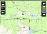
- All digitally published USGS Topographic maps of North and South Carolina available in the 1:24,000, 1:100,000, and 1:250,000 map scales
- Maps have been compressed, mosaiced, and indexed for immediate hassle free use with Overland Navigator
- Automated windows installer makes installation, configuration, or removal a snap
- Field friendly: Installs to hard drive so you don’t need an internet connection.
- * Requires Overland Navigator Map-pack (Sold Separately)
Includes the entire North and South Carolina State USGS Topographic Map collection prepared for immediate use with Overland Navigator

Price: