MapTrack downloadable Software Reviews
MapTrack downloadable Software
- Ram Used: 0
- Resolutions: Palm Standard (160×160)
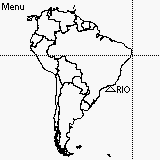
MapTrack is a PalmOS application to generate and display vector based maps on the Palm screen. You can enter your longitude and latitude coordinates and a crosshair display will show your exact position on the map. If have an NMEA enabled GPS connected, it automatically get your coordinates from the GPS and display it as a crosshair on the map. But please note that a GPS is not required to use this program. Click anywhere on a map to instantly get the latitude and longitude of that point. Measure distance and heading between two points on the map by simply clicking on them. Distance can be shown in meters, kilometers, miles, feet or nautical miles. Headings is always in true north. Waypoints can also be easily added to any map using a special built- in waypoint lookup database. You generate your own maps for any location in the world by simply downloading the vector data for that area from a special internet website called the Worldwide NOAA Coastline Extractor (see include
Price:
Find More Products

