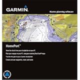
Homeport Marine Plan Software 2GB Microsd/sd Card
Homeport Marine Plan Software 2GB Microsd/sd Card
- Displays both fishing and navigational charts from BlueChart g2 Vision
- Allows user to measure distance and bearing on the charts
- Displays grid lines to show latitude and longitude
- Displays route/track depth profile
- Converts tracks into point-to-point routes and specifies speed for each leg of the route
Marine Planning Software – HomePortThis new marine planning software is a must-have tool for mariners heading out on the open water. HomePort enables the use of existing BlueChartr data from your preloaded chartplotter or preprogrammed card to help plot a course on your PC. You can then transfer this planned route back to your chartplotter and head out on your adventure. In addition to managing waypoints routes and tracks the HomePort application will also help predict fuel usage tides depth profiles and more. It can plot a course to avoid hidden underwater hazards and keep your vessel away from shallow or rocky shorelines. You can easily create point-to-point routes determine distance and bearing measurements between checkpoints and calcul

More
 iGage All Topo Maps Colorado Trail Map CD-ROM (Windows)
With iGage’s All Topo Maps CD-ROM, all of your mapping needs for the Colorado Trail are unified into one simple tool. Professiona…
 USA, Large Scale Road Atlas, 2013 (Rand McNally Large Scale Road Atlas U. S. A.)
Give road-weary eyes a break with this spiral-bound Large Scale edition featuring all the maps and accuracy you ve come to expect …

Warren Callaway "warbp"
August 18, 2012garmin homeport,
purchased this product to work with new garmin 541 unit. Mainly to transfer .adm files to .gpx…
This product made this process very easy and complete…product is very good and works well if one needs
to transfer these type files…………….wc
Was this review helpful to you?

|Wilmer
August 18, 2012Great tool,
If you are a fisherman like me or just like to go boating. This is a tool that will save you time, gas and money.
Was this review helpful to you?

|