Global Satellite Imagery-pack
Global Satellite Imagery-pack
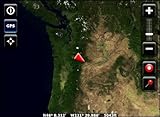
- Global Satellite Imagery – 1:1000k to Global Scales
- Images have been compressed and indexed for immediate hassle free use in Overland Navigator.
- Satellite imagery for the entire world at 8 levels having pixel resolutions of 250m, 500m, 1km, 2km, 4km, 8km, 16km, 32km
- Can be used simultaneously with Overland Navigator USGS Topographic maps.
- **Requires Overland Navigator Software (purchased separately)
Includes satellite imagery for the entire world prepared for immediate use with Overland Navigator. Packaged as a 5 DVD set containing nearly 20gb of compressed satellite imagery, Overland Navigator index files, automated installer, and Installation Guide. Satellite Imagery only, does not include aerial photography. Useful at state to global scales.

Price: