TOPO! Weekend Explorer 3D Outdoor Recreation Mapping Software (Nashville Area)
TOPO! Weekend Explorer 3D Outdoor Recreation Mapping Software (Nashville Area)
- Print photo quality USGS topographic maps
- GPS Ready – Easiest Way to tell your GPS where you want to go and record where you’ve been
- Navigate in three dimensions with 3D fly thrus and instant elevation profiling
- Customize maps with photos, notes and icons
- Live Map Update ensures you always have the most current maps and software
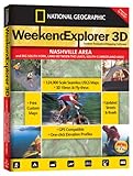
Weekend Explorer Nashville Area & Big South Fork, Land Between the Lakes N.R.A. features detailed, accurate, USGS topographic maps for Nashville Metro Area, Chattanooga, Clarksville, Cookeville, McMinnville, Monteagle, Cross Creeks N.W.R., Standing Stone State Park, Fall Creek Falls State Resort Park, South Cumberland State Recreation Area, Frozen Head State Park and Natural Area, Prentice Cooper State Forest, Franklin State Forest, and more. Weekend Explorer harnesses the power of authentic USGS topographic maps in an easy-to-use software product that recreation enthusiasts use to customize and print photo-quality topographic maps. Weekend Explorer includes five levels of seamless mapping, including USA maps from the National Geographic World Atlas, USGS 1:100,000 scale mapping — perfect for back road navigation –and USGS 1:24,000 scale maps, also known as 7½ minute quads. Users can custom-center the map in any location, add their routes, trails and notes. In addition, users can tr

List Price: $ 29.95
Price: $ 25.00