The GPS High Accuracy and Robustness Service
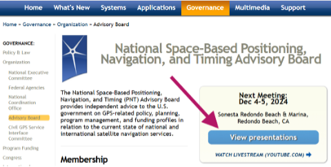
From Dec. 4-5, 2024, the National Space-Based Positioning, Navigation and Timing (PNT) Advisory Board met to discuss GPS-related topics. The PNT Advisory Board provides independent advice to the U.S. government on GPS-related policy, planning, program management and funding profiles in relation to the current state of national and international satellite navigation services. A March 28, 2024, GPS World article by Dana Goward highlighted that the PNT Advisory Board has been providing the government with independent expert advice about GPS and PNT for 20 years. He highlighted that the Board is chaired by retired Admiral Thad Allen and has six subcommittees.

This newsletter will highlight a topic that the emerging capabilities, applications and sectors subcommittee discussed at the final PNT Advisory Board meeting of 2024. The presentation title is “GPS High Accuracy and Robustness Service (HARS).” A white paper on the topic and the Dec. 4, 2024, presentation by Shachak Pe’eri, Ph.D., NOAA/NOS/National Geodetic Survey (NGS), can be found on the PNT Advisory Board website.
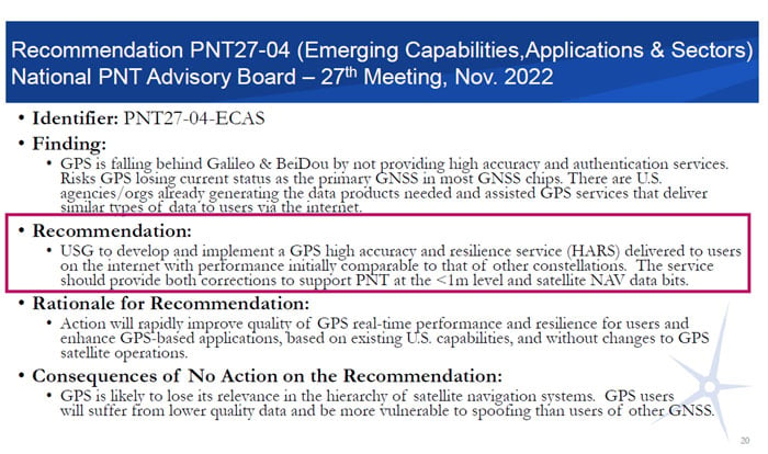
According to the document, the board prepared the white paper to support recommendation number PNT27-04-ECAS, which is to develop and implement a GPS HARS delivered to users via the Internet. The HARS concept was approved at the PNTAB-27 meeting (Nov. 16-17, 2022) and formally submitted to the National Space-Based PNT EXCOM co-chairs via Memorandum on Jan. 27, 2023.
The November and December Advisory Board meetings are recorded, and individuals can listen to the entire meeting. The Board’s website provides links to the meeting agenda and presentations. Pe’eri’s presentation on HARS started at 10:30 am on Dec. 4 (2:04 on the recording).
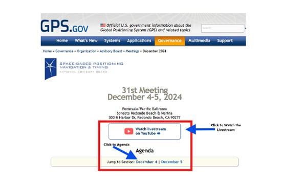
Day 1 can be found here.
During the meeting, the PNT Advisory Board officially stated that it supports the HARS Concept described by NOAA. Of course, the Board also stated that it has no money, but the Board’s stamp of approval of the concept is very important. Now, it is up to NOAA’s NGS to work with other federal agencies, such as NASA’s Jet Propulsion Laboratory (JPL), to work out the details and resources. By leveraging NASA’s real-time Global Differential GPS (GDGPS) System infrastructure and NOAA’s service delivery platforms, a high-accuracy, resilient service that ensures delivery of precise, reliable and secure GNSS corrections for a wide range of scientific and commercial applications can be built for the nation.
So, what exactly is the GPS High Accuracy and Robustness Service (HARS)? The following is a statement from a Jan. 27, 2023, PNT Memo:
“Implementing a GPS High Accuracy and Robustness Service: To augment GPS and overcome some inherent limitations of space-based PNT, the USG should provide a service comparable to the European Union’s Galileo HAS that provides signal corrections than enable better than one-meter level accuracy, as well as cryptographically-protected satellite navigation message data bits for integrity processing. The U.S. should develop and implement GPS HARS, based on the capabilities developed by the JPL for GDGPS, to be made available to users over the Internet.”
The white paper describes the problem and the solution as the following:
“The problem: GPS is falling behind other Global Navigation Satellite Systems (GNSSs) such as Europe’s Galileo and China’s Beidou. GPS has adopted an approach of allowing augmentation by third-party systems (such as Assisted-GNSS in mobile phones, WAAS for aviation accuracy and integrity, and commercial RTK for precision users), rather than providing specialized advanced services itself. Also, the data message modulated on the GPS signals is fragile. Environmental effects or malicious actions can prevent a receiver from reading the information or manipulate what is read, limiting the robustness of the GPS signals. Currently, GPS is the primary system in almost all GNSS chips, even chips made in Europe or Asia. That is: chips are designed to acquire GPS signals first, then signals from other systems. But Galileo and BeiDou are deploying high accuracy services that provide sub-meter position accuracy, enhancing satnav use in many civil applications. The absence of any plan for GPS to offer a similarly high accuracy service could cause GNSS chips to begin using Galileo or BeiDou, rather than GPS, as the primary system. A switch away from GPS as the primary PNT system is a problem for the US Government because it will lose its strategic advantage. Existing commercial chips are used in many strategically important US assets, such as airlines, ships, and organizations that support the US military. Once these chips change their architecture to Galileo-first or BeiDou-first, these strategic use cases depend on these services. It is one step in the direction…