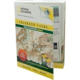
National Geographic Trails Illustrated Explorer Colorado 14ers Topograhical Map CD-ROM (Windows or Mac)
National Geographic Trails Illustrated Explorer Colorado 14ers Topograhical Map CD-ROM (Windows or Mac)
- Mac/ PC Compatible
- Transfers Routes Waypoints and Tracks to Most GPS
- 3D Fly Through Feature
- Prints Detailed Maps
- Easy to Use
Colorado 14ers Explorer contains detailed Trails Illustrated maps, plus genuine USGS 1:24,000 and 1:100,000 scale topographic maps, in a large 14-mile radius around each Fourteener. All maps are seamless, and easily printed from your home printer complete with scale bar, compass rose, GPS grids and your own custom notes and symbols. Technical specs, pictures, and guidebook-like information for each peak, provided by the Colorado Fourteeners Initiative, plus an interactive journal for recording your trips, makes it easy to plan, save, and recount your trips. Gain an enhanced perspective on your route with 3D fly-thrus, elevation profiling, plus tools for measuring real-terrain distances, slopes, bearings, and more. A robust search tool makes it easy to quickly locate summits, towns, lakes and other features. Colorado 14ers Explorer is both Mac and PC compatible and enables import/export of routes, waypoints, and tracks with nearly all handheld GPS receivers. Detailed Feature List: Seaml
List Price: $ 49.95
Price: $ 27.95
Find More Products

