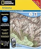
National Geographic TOPO! Arizona Map CD-ROM (Mac)
National Geographic TOPO! Arizona Map CD-ROM (Mac)
- Includes hundreds of printable National Geographic and USGS topographical maps of Arizona
- Annotate your maps with trail routes, notes, web links and photos
- Export maps as .gif or .jpg formats of use in other applications
- Easily transfer waypoints and routes with your GPS
- Create, view and print elevation profiles
Award-Winning TOPO! Mapping SoftwareWith the TOPO! map of Arizona, National Geographic has taken the interactive topographic map experience to a new level. By combining its own standard-setting maps with the high-quality scanned versions of the actual paper USGS topographical maps, the National Geographic TOPO! State Series offers five levels of map detail that is unprecedented in its accuracy. Professional and weekend hikers alike will be amazed at how indispensable TOPO! will quickly become in the back country. Simply load TOPO! onto your PC, and you’ll immediately begin to see the benefits of this award-winning software. With TOPO! you can customize any of the hundreds of state maps available with your proposed routes, notes and even photos. You can also create and view elevation profiles that will help you visualize your planned trek. By connecting to any standard color or black-and-white desktop printer, TOPO! allows you to select the exact area that you want to print, even if it
List Price: $ 99.99
Price:
More Products

