Marine chart updates exceed 12 million in 2025
January 14, 2026
As the #1 mapping solution1, Garmin is dedicated to providing the most up-to-date and accurate charts for users around the world. And in 2025, we delivered — with more than 12 million chart updates, surpassing 2024’s updates.
The updates help ensure that mariners can navigate their desired routes easily and efficiently with updated shorelines, docks and marinas. Plus, more marked hazards and detailed navigational aids such as buoys and lights make for even better cruising.
What’s new?
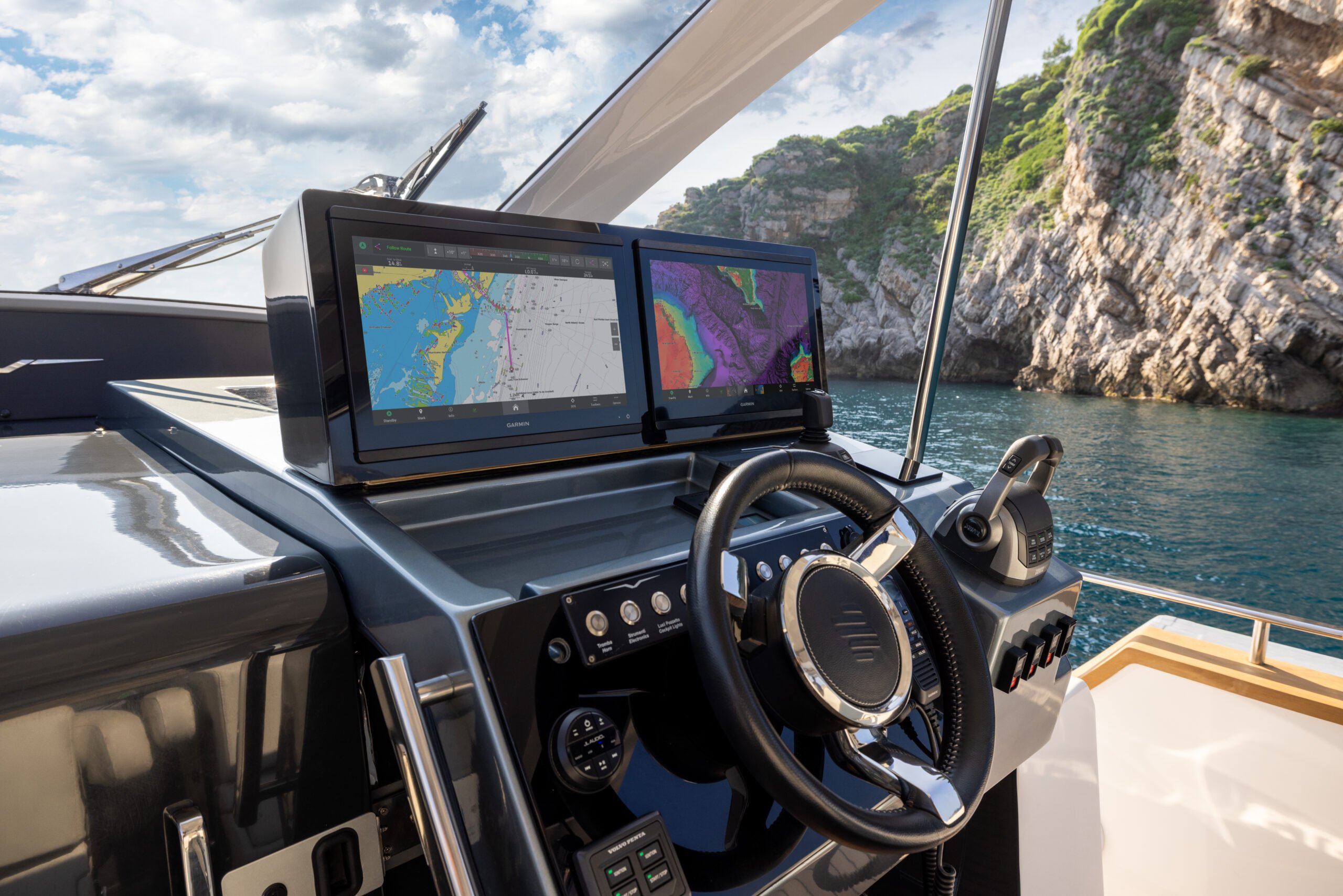
Fishing chart updates: With depth data from user sonar logs and targeted survey activities, it’s likely Garmin added a few of your favorite fishing spots to charts. In 2025, sonar logs integrated into Garmin fishing maps exceeded 12 million.
Relief shading: Sonar data, surveys and crowdsourced depth data are continually processed to improve the relief shading overlay and provide boaters with enhanced detail through quarterly updates. With the influx data from all over the world, high-resolution relief shading images are enhanced to better show underwater structure and overall bottom landscape.
Labels and navaids: Cruise with better situational awareness from improvements including concise and clear labels and navaids for enhanced navigation. Labels became increasingly readable with limited clutter while navaids included new and updated symbols, enriched information, and improved visibility of lights and light sectors.
Other notable mentions include:
- Approximately 111,800 miles (about 180,000 kilometers) of coastline updates
- More than 15,000 Notice to Mariner updates
- Upwards of 16,000 electronic navigation chart (ENC) updates
- Almost 700 new paper charts
See the latest updates to marine mapping and view our most recent charts to find the right navigation tool for you.
Get daily updates, detailed charts and high-resolution imagery with a Garmin Navionics+™ or Garmin Navionics Vision+™ subscription. For Garmin chartplotter users, purchase a new chart and receive a 1-year renewable subscription. Select chartplotters have preinstalled Garmin Navionics+ charts. Download the ActiveCaptain® app on your compatible mobile device or download our Garmin Express™ software on a computer to keep your charts up to date. For non-Garmin chartplotter users, Navionics+ and premium Navionics Platinum+™ can be purchased. To access charts without a chartplotter, check out the feature-packed Navionics® Boating app.
Download your desired Garmin charts with improved coastal and lake mapping today. Enhanced navigation and smooth sailing is on the horizon.
1Based on 2024 sales