How Garmin mapping can help you for your next marine adventure
September 16, 2025
Whether you have a center console boat, sailing yacht or kayak, there are endless ways to explore the water around you. No matter where you’re navigating or what activity you are doing, having the right mapping is essential. Here’s how Garmin mapping can help you take on your favorite boating activities.
Garmin marine mapping for you
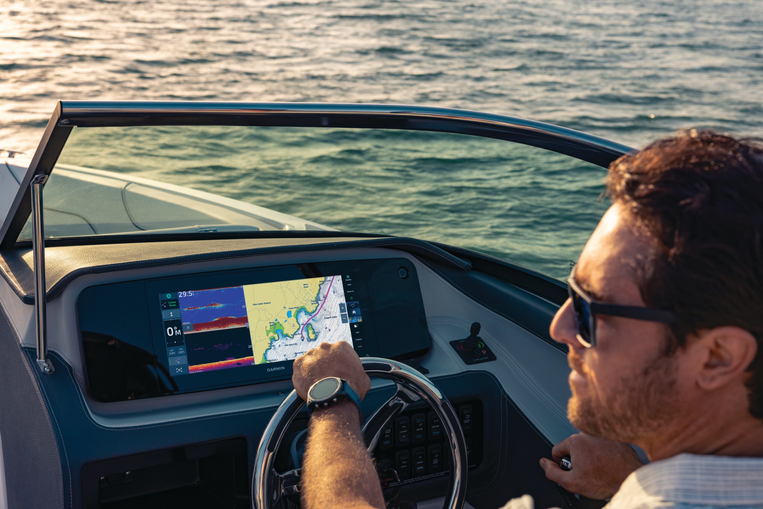
When you have a compatible Garmin chartplotter, integrated Garmin Navionics+™ charts are essential for any coastal or inland boat. For Garmin users in U.S., Canada, the U.K. Ireland and Holland, and Australia and New Zealand, this detail-rich mapping — with depth range shading, up to 1’ contours and more — is available built in to our GPSMAP® and ECHOMAP™ chartplotters. Marine charts, including premium Garmin Navionics Vision+™ for any region, can also be purchased via the ActiveCaptain® app or on preprogrammed cards.
For boaters with chartplotters from other brands, take a look at Navionics+ and Navionics Platinum+™ charts. If you don’t have a chartplotter, the Navionics® Boating app is for you. Regardless of how you get your maps, chart detail will remain the same.
Here are some of the ways Garmin nautical charts and lake maps can help you during your favorite boating activity.
Ocean voyagers
Whether you’re preparing for the circumnavigation you’ve been dreaming about or a multiday trip to a faraway shore, you’ll be able to use Garmin Navionics+ coastal charts with Auto Guidance+ technology1 for suggested dock-to-dock routes. You’ll also be able to see navigational aids, depth information and shipping lanes along your route. Additional information such as marina details about dockage, amenities, fuel and service information are also available.
Offshore fishing
For those who love the thrill of getting an early morning start to fish for big-water species such as swordfish or marlin, our detailed charts help you locate fish-holding structures, such as canyons located well offshore, to save you both fuel and time searching for fish. When you come across changes in depth, you’ll be well aware with the high-resolution relief shading feature with an intuitive color palette that allows you to easily see areas that are deeper than others.
Sailing the Nordics
Sailing the Nordics is full of adventure and beautiful sites, but this destination presents its own challenges. With narrow channels, hazardous shallow areas and strong currents, it’s important to be well-informed on the conditions. The archipelagos, for example, contain hundreds of thousands of islands that are stunning but tricky to navigate. With Garmin navigation charts and Auto Guidance+ technology, you’ll be equipped to make your way while remaining aware of channel markers, hazards and wrecks as well as marine services that can offer support if needed.
Freshwater fishing
With more than 88,000 Garmin lake maps around the world, including more than 26,900 lake maps in the U.S., you can be prepared with depth data to help you locate your target species. Whether you are searching for largemouth bass on your favorite lake in Texas or zander in the inland waters of Poland, you’ll have access to shoreline structures such as docks (which can be great fishing locations), boat ramps and marinas. Aside from high-resolution relief shading and depth range shading, take advantage of the dynamic lake level feature. With premium map subscriptions, your compatible chartplotter will be able to detect your position and let you adjust your maps to display current water levels and depth values when there are changes due to precipitation/drought or drawdowns on dam flow levels. For depth information, Garmin fishing maps offer contour intervals up to 1’ in U.S. waters and up to 0.5 meters in all other locations.
River cruising
Several parts of the world offer scenic trips along navigable rivers. For many river cruisers, it’s a way to be immersed in the beauty of coasting through some of the world’s most beautiful natural sites. If you plan to take a trip through America’s great loop, or any other course, Garmin navigation charts display data regarding port plans and safety depth contours, navigational aids and more. When you’ve downloaded the Garmin ActiveCaptain app to your compatible smartphone, you can save and update your favorite routes, and with the ActiveCaptain Community, you can see reviews about marinas and anchorages from fellow cruisers right on your chartplotter.
Kayaking
Kayaking is not only a great workout, it’s an easy way to access all the pleasures of being on the water. Having a good map to keep track of your location when you’re navigating the maze of marsh grass during low tide is crucial. With the Navionics Boating app, you’ll be able to track your location, plan routes, measure distance, create waypoints and more. If…