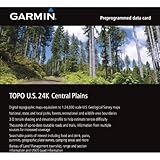
Garmin TOPO! 2004 Central Plains U.S. Map microSD Card
Garmin TOPO! 2004 Central Plains U.S. Map microSD Card
- Provides detailed digital topographic maps, comparable to 1:24,000 scale USGS maps, for Oklahoma, Kansas, Missouri, and Arkansas
- Contains detailed hydrographic features, including, coastlines, lake and river shorelines, wetlands and perennial and seasonal streams
- Provides elevation profile on compatible Garmin devices so you can estimate terrain difficult
- Contains many routable trails, rural roads, city neighborhood roads, major highways and interstates
- Displays national, state and local parks, forests, conservation areas, wilderness ares, Bureau of Land Management (township, range, and section) information, and USGS quad locations
Outdoor enthusiasts: your adventure is waiting – in vivid detail. TOPO U.S. 24K – Central Plains brings you the highest level of topographic detail available, with maps comparable to 1:24,000 scale USGS maps. These highly detailed maps include terrain contours, topo elevations, summits, routable roads and trails, parks, coastlines, rivers, lakes and geographical points – and they also display 3-D terrain shading on compatible devices. TOPO maps are ideal for hiking, hunting, camping, cycling and communing with nature. Coverage includes topographic detail of Oklahoma, Kansas, Missouri and Arkansas.
List Price: $ 99.99
Price: $ 70.00

