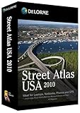
DeLorme Street Atlas USA 2010 [OLD VERSION]
DeLorme Street Atlas USA 2010 [OLD VERSION]
- DeLorme Street Atlas USA 2010 us exceptionally detailed map software you can use anywhere–on the go with your laptop PC, netbook, touchscreen phone or PDA
- Includes street-level detail for the U.S. and Canada, plus highways and major roads for Mexico
- Pre-plan your trips with automatic routing and over 4 million places of interest–restaurants, lodgings, attractions, truck stops, sports venues, and businesses of all kinds
- User controls let you plan side trips, avoid congested areas, choose back roads, and more
- GPS-ready–connect a DeLorme Earthmate or other receiver to your laptop and receive spoken directions
STREET ATLAS USA 2010 (WIN XPVISTA/DVD SOFTWARE)Updated map software for PCs, Palm and Win CE touchscreen devices. U.S. and Canada street-level detail, automatic routing, 4 million places of interest. GPS-ready–on-the-go routing wizard, spoken directions, 3-D perspective. Travel planning and GPS navigation for laptops, netbooks, phones, and PDAs
Updated, exceptionally detailed map software you can use anywhere–on the go with your laptop PC, netbook, touchscreen phone or PDA. No Internet access or subscription required. Get street-level detail for the U.S. and Canada, plus highways and major roads for Mexico. Pre-plan your trips with automatic routing and over 4 million places of interest. User controls let you plan side trips, avoid congested areas, choose back roads, and more. Locate restaurants, lodgings, attractions, truck stops, sports venues, and businesses of all kinds. Calculate fuel usage and costs. Customize the maps to meet your needs. Import aeri
List Price: $ 39.95
Price: $ 14.40


Richard E. Kolson
August 28, 2011Street Atlas gives routing choices,
The reviewer who can’t get the multi-stops chosen to be in geographic order is not entering them correctly. When deciding to put a “stop” into your route, how you do it determines how the software works. If you choose “ADD A STOP” the software will put that stop into the sequence that you entered it. For instance, if you want to stop at Aunt Jane’s first, then go to Sam’s house, you would add those stops in the order you want to do them.
If you want multiple stops to be made in the shortest geographic distance and the sequence of the stops is not important, use “INSERT A STOP.” The software will then arrange the stops to be made in the most efficient manner.
To choose the ADD or INSERT for a STOP, go the Route tab, choose New/Edit, and use the drop-down box at the end of the Stop window to pick either Add or Insert.
The new Street Atlas has excellent Point of Interest options, and allows flexible routing by using the ADD VIA and INSERT VIA options.
Was this review helpful to you?

|