What is overlanding? How can you overland with Garmin?
December 19, 2025
You’re lounging in your camp chair, gazing up at the stars you haven’t seen in months, surrounded by changing leaves and it’s finally quiet, save the sounds of your crackling campfire, chirping crickets and a stream gently rushing by.
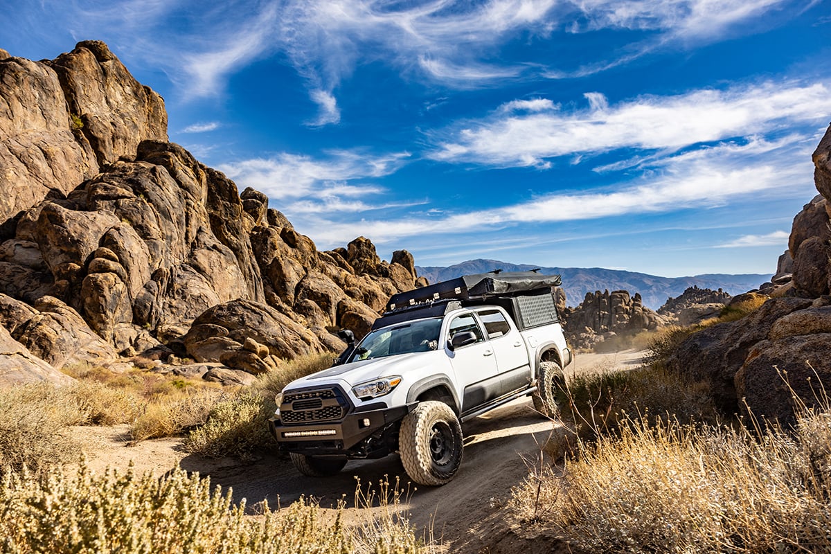
Your reliable truck or rig is parked next to you, its rooftop tent calling you to sleep. A wave of peace settles over you. Not a soul is in sight.
How did you get here? By overlanding.
If you’ve got a capable vehicle, the outdoor essentials and the ability to be self-reliant, this could be you. And when you overland with Garmin products, you’ll be better prepared to explore off the beaten path.
What is overlanding?
Overland Journal defines overlanding as “self-reliant adventure travel to remote destinations where the journey is the primary goal.” You rely on your vehicle to travel off-road and lead you to sights you’ve never seen while you search for remote and makeshift campsites.
When you overland, it’s all about getting out in nature and living simply off the land, using the supplies you brought with you.
It differs from your typical camping or car camping trip because the goal isn’t arriving at established, easily accessible campgrounds. Instead, it’s about the journey you take to a remote campsite, possibly on challenging roads or trails.
What Garmin products belong in your vehicle?
First, you’ll want to make sure you have all the gear, food, water, gas and sleep essentials packed in your overlanding rig. And you don’t need a heavily modified vehicle — just one that’s capable and that you can rely on.
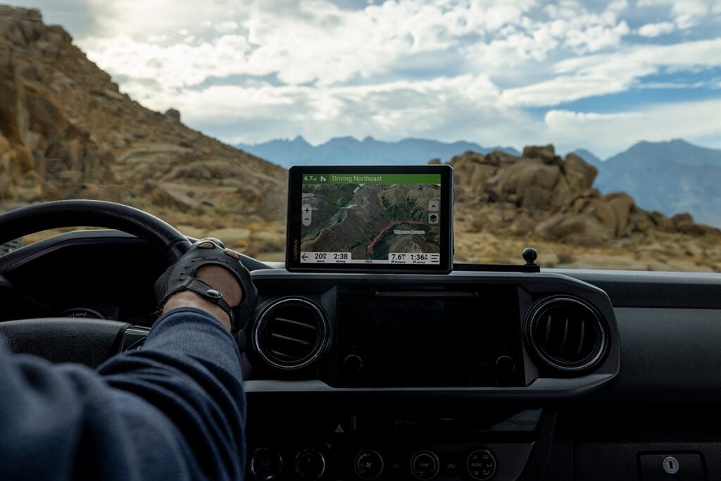
In that vehicle, you can mount a Garmin off-road GPS navigator such as Tread 2 – Overland Edition, an 8″ device that can help guide you through the toughest conditions with turn-by-turn trail navigation1 and topographic maps for North and South America. It includes high-definition elevation maps, a preloaded directory of more than 46,000 Ultimate Public Campgrounds and more. Plus, with public land boundaries, you can be aware of boundaries for national forests, Bureau of Land Management and wilderness areas, as well as private land boundaries and landowner information for parcels greater than 4 acres — for insight on where you can and cannot legally camp and travel.
You can even get custom street routing for the size and weight of your vehicle as well as alerts for potential hazards on your route, including sharp curves, steep grades and more2. Tread 2 – Overland Edition includes a heavy-duty suction cup and robust magnetic-assisted locking mount to secure it to your dashboard.
With the Tread® mobile app, you can discover the best rated off-road routes thanks to the great rides feature. Bookmark a ride to sync it with your Tread navigator. After your ride, you can rate the difficulty and upload pictures.
You’ll also want to add the Garmin PowerSwitch™ compact digital switch box to your vehicle. This provides convenient centralized control of your vehicle’s 12-volt accessories from a compatible3 Garmin navigator such as Tread 2 or your compatible smartphone4. Garmin PowerSwitch helps you control light bars, horns, air compressors, locks and more. Plus, this rugged switch box is IPX7 weather-resistant, so it’s tough enough for your off-road adventures.
Should you grab a GPS handheld for mapping?
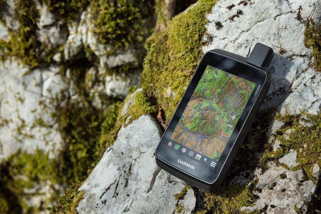
You’ve got the in-vehicle device covered, but what else should you bring for when you leave the vehicle for other activities such as hiking, cycling, hunting and fishing? We recommend a durable device that goes wherever you go, tracking your precise location along the way, such as eTrex® Touch, GPSMAP® H1 or Montana 710 handheld navigators.
The preloaded TopoActive maps with routable trails and roads on eTrex Touch make it a great option for any outdoor activity. It offers a simple-to-use touchscreen, durable design, long battery life and the option to purchase an Outdoor Maps+ plan for ongoing access to premium map content (more on that later).
If a larger touchscreen map is a priority for your adventures, consider Montana 710. It features a 5″ glove-friendly touchscreen — ideal for when you want to view a larger map — and a rugged design. This handheld includes preloaded TopoActive maps, downloadable satellite imagery and compatibility with optional Outdoor Maps+ content.
If you’re looking for a feature-packed navigator, step up to GPSMAP H1. This premium GPS handheld includes a built-in flashlight and siren, more advanced mapping, downloadable high-resolution satellite imagery and Outdoor Maps+ compatibility. The modern and hybrid design offers a 3.5″ color touchscreen and physical buttons, with a durable…