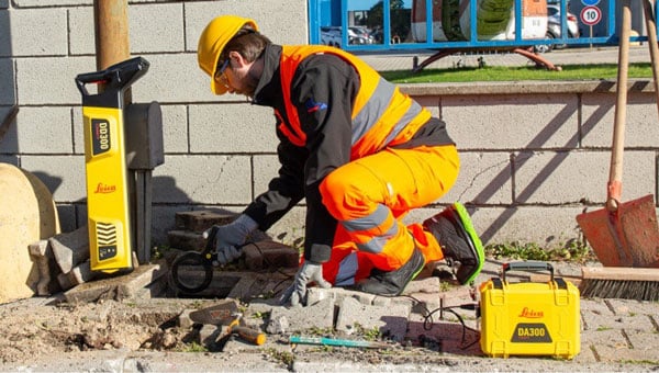
Leica Geosystems advances utility detection
Leica Geosystems, part of Hexagon, has launched the Leica DD300 CONNECT utility locator and Leica DA300 signal transmitter, a combined, ready-to-use solution for versatile utility detection.
The solution aims to enable professionals to make accurate, in-depth underground investigations and obtain on-the-spot insights regarding the underground network.
Users new to surveying can access video tutorials on the LCD for a step-by-step approach to surveys. Meanwhile, expert users can access a comprehensive range of advanced features. For example, the digital trim allows manual management of the gain bar to adjust the device’s sensitivity. It also offers a wider range of acquisition frequencies between 33 kHz and 131 kHz, including a unique 83 kHz frequency which is ideal for long-distance tracing.
The new utility locator seamlessly integrates with the Leica DX Shield software, providing easy-to-use tracking tools and a centralized hub for managing on-site activities and multiple devices. Operators can also connect the hardware to the DX Field Shield app, enabling real-time remote data transfer of cable locator information directly to the office. Additionally, the USB connection offers convenient data download, analysis and product maintenance with self-calibration functionalities through DX Shield Office software.
Detecting the position of underground utility networks is key to increasing worker safety and avoiding damage to underground infrastructures. The new Leica DD300 CONNECT is designed to improve safety and mitigate personnel and property damage risks.

The Leica DD300 CONNECT and DA300 Transmitter. (Photo: Leica Geosystems)
