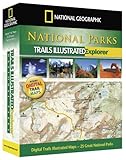
National Parks Explorer (National Park Maps)
National Parks Explorer (National Park Maps)
- Each map features a PDF with additional travel and recreation information for that area.
- Print your own maps with National Parks Explorer 3D. Print in color or grayscale, add lat/long or UTM grids, center on the area you want, and print on your home printer.
- Customize the maps with digital photos, notes, and symbols.
- Use with your GPS device by transferring waypoints and routes between the software and your handheld GPS unit. Store, organize, and manage an unlimited number of waypoints in the software.
National Geographic’s National Park Explorer is the ideal way to get detailed topographic trail maps for your next National Park visit!
National Park Explorer includes thoroughly researched and up-to-date maps of the top 25 most popular national parks with our easy to use TOPO! map software.
Using your Mac or PC and any home printer, you can browse, customize, and print the exact maps you need for your trip. GPS users can plan their trips in detail and import/export their routes, waypoints, and tracks. Additional map tools enable you to calculate distances, view elevation profiles, and explore the terrain in 3D.
National Park Explorer includes detailed maps for: Acadia, Arches, Big Bend, Bryce Canyon, Canyonlands, Channel Islands, Death Valley, Glacier/Waterton, Grand Canyon, Grand Teton, Great Smoky, Isle Royale, Joshua Tree, Kings Canyon, Mt. Rainier, North Cascades, Olympic, Redwood, Rocky Mountain, Sequoia, Shenandoah, Theodore Roosevel
List Price: $ 49.95
Price: $ 18.25

